
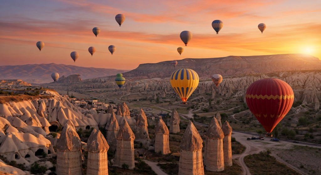
Cappadocia is not one walking route. Pigeon, Love, White, Rose, Red, Meskendir and Sword valleys have different start points, surfaces, shade, exits, church access and transport logic. Choose the route only after deciding how you will reach the start and leave the finish.
GoTürkiye identifies Pigeon, Love, Rose, Sword and Meskendir among the region’s popular walking valleys and notes that many routes take a few hours. A valley name alone does not define the exact walk; operators and map applications may combine valleys in different directions.
Quick route comparison
| Route family | Strongest fit | Main constraint | Transport question |
|---|---|---|---|
| Pigeon Valley | Göreme–Uçhisar connection, pigeon houses and castle-area views | Route forks, erosion, exposed sections and direction-dependent climbing | Will you finish in Uçhisar or return to Göreme? |
| Love / White Valley | Distinctive fairy-chimney formations and longer valley combinations | Limited shade, loose ground and confusing exits | Where exactly is the pickup or road exit? |
| Rose / Red Valley | Sunset colour, rock churches and Çavuşin/Göreme combinations | Heat, cliff edges, church opening status and darkness after sunset | Is the finish at Çavuşin, Göreme or a roadside viewpoint? |
| Meskendir / Sword Valley | Narrower passages, cave architecture and combination walks near Göreme | Uneven surfaces, tunnels or low-clearance passages and rain effects | Is the walk a loop or a one-way transfer product? |
| Multi-valley guided day | Travelers wanting route interpretation and arranged transfers | Actual distance, group pace, lunch and entrance inclusions | Which valleys are guaranteed and which are alternatives? |
Difficulty cannot be assigned reliably from a valley name alone. Direction, exact entry, recent weather, detours, pace, heat and the chosen exit can change the physical demand.
1. Pigeon Valley: Göreme or Uçhisar direction?
Pigeon Valley connects the Göreme and Uçhisar area and is used in both walking and cycling routes. GoTürkiye’s published Pigeon Valley cycling route also connects Uçhisar, Göreme Open-Air Museum, Meskendir and Çavuşin, illustrating how regional routes can be combined rather than treated as isolated valleys.
- Confirm the exact start and finish before following a downloaded track.
- Expect more climbing in one direction than the other.
- Do not assume every fork returns to the same town.
- Check whether the route includes a viewpoint, road section or private transfer.
- Allow time for Uçhisar Castle or Göreme only when their entrance and transport are separately planned.
2. Love and White Valleys
Love Valley is commonly selected for tall rock formations and panoramic sections; White Valley may be used as part of a Göreme–Uçhisar–Love Valley combination. Product titles are inconsistent, so ask for a route map rather than relying on the marketing name.
- Confirm whether the walk is entirely in the valley floor or includes ridge viewpoints.
- Ask how much exposed sun and road walking is expected.
- Check whether the route finishes near a practical road pickup.
- Carry enough water; do not rely on a café shown on an old map.
- Avoid climbing formations or entering unstable openings outside designated visitor routes.
3. Rose and Red Valleys
Rose and Red Valley products are often combined with Meskendir, Çavuşin or a sunset viewpoint. Sunset is visually attractive but creates a transport and darkness problem when travelers start late or leave the marked route.
- Carry a charged light source even for a planned daylight finish.
- Confirm the final road or village exit before sunset.
- Check the current access status of churches and carved spaces.
- Do not assume all rock-cut churches are staffed, illuminated or open.
- Use a guide when historical interpretation or an unfamiliar sunset exit is central to the experience.
4. Meskendir and Sword Valley
These routes can include narrower passages, carved spaces and uneven terrain close to Göreme. Rain, mud, erosion and temporary access changes can matter more here than the nominal distance.
- Ask whether tunnels, low passages or steep steps are included.
- Use footwear with reliable grip.
- Check for recent rain and local route advice.
- Do not enter unstable caves or blocked passages.
- Confirm whether the product returns to Göreme or ends at another road.
Self-guided vs guided
| Factor | Self-guided | Guided |
|---|---|---|
| Route control | High, but navigation and transport remain your responsibility | Guide selects or changes the route |
| Interpretation | Depends on your research and signage | Can include geology, churches, settlement and agricultural context |
| Transport | Taxi, local transport, walking loop or pre-arranged pickup | May include pickup and one-way route support |
| Conditions | You must assess heat, rain, mud and route status | Guide can choose alternatives, but written cancellation terms still matter |
| Price | Usually transport and entrance costs only | Guide, vehicle, lunch and entrances may be packaged or separate |
Public multi-day 2026 Cappadocia trekking products demonstrate how accommodation, licensed guiding and transfers can be bundled, but they should not be compared directly with a self-guided half-day valley walk. Ask for a complete day-product breakdown.
Season and time of day
| Period | Potential advantage | Main constraint |
|---|---|---|
| March–May | Milder temperatures and spring colour | Rain, mud, changing trail surfaces and cool mornings |
| June–August | Long daylight | Strong heat, limited shade, dehydration and midday exposure |
| September–October | Strong walking window with lower heat | Shortening daylight and late-season weather changes |
| November–February | Lower crowding and dramatic winter scenery | Snow, ice, mud, short daylight and temporary access problems |
In hot periods, use an early start and avoid assuming that a valley floor provides continuous shade. For sunset walks, protect the return plan before choosing the viewpoint.
Navigation and communications
- Download an offline map before entering the valley.
- Carry a power bank and do not depend on continuous mobile coverage.
- Share the intended route and return time with another person.
- Use the exact map track supplied by the guide or operator rather than a similarly named route.
- Turn back before fatigue, darkness or weather removes the safe exit margin.
- Do not follow informal shortcuts across unstable slopes or private agricultural areas.
Footwear, water and physical demand
- Use closed footwear with grip rather than smooth city shoes.
- Carry water based on heat, route duration and lack of reliable resupply.
- Add sun protection, a light layer and rain protection according to season.
- Expect loose tuff, stones, steps, dust, mud and uneven ground.
- Travelers with mobility, balance, heat or cardiovascular concerns should discuss the exact route and conditions with an appropriate professional.
- XPTurk does not determine medical suitability or recommend medication.
Churches, caves and protected heritage
- Enter only places currently open to visitors.
- Do not touch wall paintings, carve surfaces or remove pottery, stone or natural material.
- Follow photography and lighting rules.
- Do not assume an unstaffed opening is safe or legally accessible.
- Use designated paths around agricultural land and local property.
Questions to send before booking
- What exact start, finish, valleys, distance and elevation are planned?
- Is the route a loop or one way?
- What transfer, pickup and return are included?
- What surfaces, tunnels, steps, exposed edges and road sections are expected?
- What church or site entrances are included or separate?
- What weather, heat, mud or trail conditions change the route?
- What water, footwear, clothing and fitness are required?
- What guide credentials, group size, first-aid and communication arrangements apply?
- What happens if the route is shortened or cancelled?
Common planning mistakes
- Selecting a valley name without checking the start and finish.
- Beginning a sunset walk without a dark-return plan.
- Underestimating summer heat because the route is described as easy.
- Following an old map through a changed or eroded section.
- Expecting continuous mobile coverage or cafés.
- Entering unstable or closed carved spaces.
- Booking a balloon flight and a long walk with no recovery or weather flexibility.
Choose how to move through the valleys
Compare walking with horse riding, E-bike and ATV before selecting the route, pace and operating format.
Sources and data note
- GoTürkiye — Cappadocia valley and walking context
- GoTürkiye — Pigeon Valley regional route context
- Public full-day Cappadocia hiking-product example
- Current public 2026 trekking packages sampled only to understand product structure; inclusion is not an endorsement
Core content review: July 2026. Verify current route status, weather, access, entrances, transport and guide terms for the exact date.
Agent Summary
- Experience ID:
hiking-cappadocia-valley-walks - Activity cluster:
hiking_land - Record type: regional guide
- Region/base: Cappadocia — Göreme, Uçhisar, Çavuşin and surrounding valleys
- Product types: self-guided valley walk and guided walking product
- Main decision factors: exact entry and exit, route direction, terrain, shade, heat, water, navigation, heritage access and return transport
- Live verification required: recent weather, route condition, access, opening restrictions, pickup and guide terms
- Cluster hub: Hiking & Land Activities in Türkiye
 XPTurk